Wednesday, May 3, 2017

SAWH -> SCCF

Route distance: 2064nm
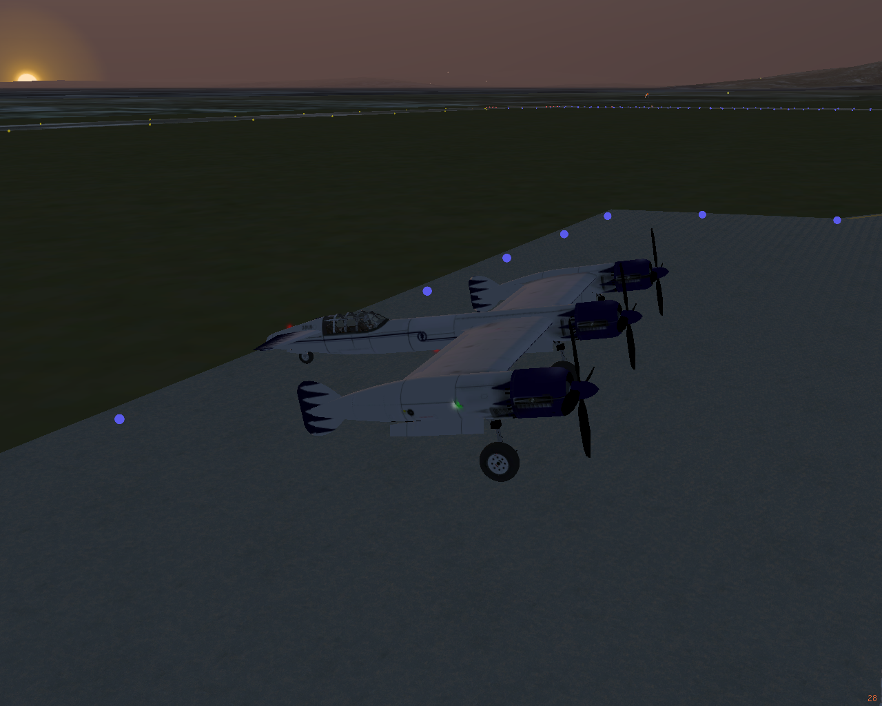
Plane used: JA-37Di
Route: https://skyvector.com/?ll=-46.65853255820889,-73.32000731758306&chart=301&zoom=1&fpl=%20SAWH%20NAS%20B432%20ECA%20W48%20ASOPA%20G550%20BAL%20UG550%20TEN%20TEN%20TEN%20T126%20MON%20Q802%20NIA%20V551%20CHI%20G551%20AMB%20V551%20TBN%20T114%20DAT%20V200%20FAG%20NEDAV%20SCCF

The Andes are pretty.


Monday, September 19, 2016

Friday, October 30, 2015

Leg 14: ENKR Kirkenes-Hoybuktmoen to ENSB Longyearben

Total distance traveled: 7535nm
Route distance: 655nm
Plane used: BV-170
Route: ENKR - ENAT - ENHF - ENBJ - ENSB

Taking off from ENKR, I decided to continue my route to ENAT, and then turn north. I stopped and ENHF, partly to refuel, partly because I couldn't turn down a chance to land at a place called Hammerfest. Gorgeous coast line, gorgeous airport. Definitely on my favorites list.

From there, it was bearing 3-4-0 to ENBJ (which isn't in SkyVector - it's a small island between Norway and Svalbard), and then continuing on the ENSB. Svalbard was very pretty, with lots of mountainous terrain. It's so far north, that at this time of year I landed in the dark (at around noon local time). Heres me landing at ENSB airport:


I'll probably explore Svalbard before taking off on the trip to CYLT, which is going to be interesting.

Leg 13 - USDD Salekhard to ENKR Kirkenes-Hoybuktmoen

Total distance traveled: 6880nm
Route distance: 906nm
Plane used: BV-170
Route: USDD - NRM - ULMM - 69 26' 27" N 28 43' 33"E - ENKR

Leaving Russia!
WoooOOooOooOOOooOo!

This was lame/fun.


It was a pretty straightforward flight. Navaids were 300nm-500nm apart, just due to there being nothing up there.

On the stretch from ULMM to ENAT, my internet crashed, so Terrasync stopped working and the terrain data from my local files didn't load... so no terrain. I emergency re-routed to ENKR, which was ~30nm distant from where I was at.

ENKR was a very pretty airport. If you're ever up north, I recommend it.

Wednesday, October 28, 2015

Leg 12 - UOOO Norilsk to USDD Salekhard

Total distance traveled: 5974nm
Route distance: 498nm
Plane used: BV-170
Route: UOOO - USDD

Here is our lovely N69 line again.

Pretty uneventful.
Flightgear crashed halfway through (again), but my plan to pre-download scenery worked out pretty well.


Tuesday, October 27, 2015

Leg 11 - UEST Tiksi to UOOO Norilsk

Total distance traveled: 5476nm
Route distance: 842nm
Plane used: BV-170
Route: UEST - UOHH - UOOO


Change of plans - after tweaking the flight model, I don't think I can make the 1,600nm trip to CYLT, so instead I'm headed to UOOO via UOHH.
I decided to head out at dawn.


This was pretty much my view for most of the flight.


I was veeeeeeeery glad to arrive at UOHH. It was the longer leg of the journey, and arriving here meant I only had another 350nm to go.


At about 150nm to UOOO, the clouds rolled in. I tuned in my ATIS to here that conditions were worsening. "Expect ILS landing" and "snow falling and drifting" and "winds at 30kts" were... not was I was hoping for.

At about 80nm, I dipped down into the soup to confirm something I was worried about - Terrasync had  failed (again). I ended up having to jot down my GPS coordinates and restart after manually downloading the scenery. I don't think I'm ever going to rely on Terrasync again, but I'll keep it running in the background. It's just disheartening to make a ~900nm trip only to have to reset the simulator because you don't have the scenery.

Back on topic: the soup was thick, and IFR flight in the BV-170 is very hard. It just flat out doesn't have the instrumentation for it. My view:


I was glad it was dawn, so I could see the runway lights through the soup.


And this was my landing conditions. Holy moley.


So, there you have it. Aside from simulator issues, a moderately boring flight until the landing.

Friday, October 23, 2015

Leg 10 - UHMP Pevek to UEST Tiksi - and news regarding the BV-170

Total distance traveled: 4634nm
Route distance: 837nm
Plane used: BV-170
Route: UHMP - UEBN (Nizhneyansk, not in SkyVector) - UESO - UEST


Flying over northern Russia (see that line thing - it goes on for several thousand miles like that). The total leg distance for this one was approximately 800nm, and I was using it as a testbed for the next leg of the flight: flying over the North Pole to CYLT. I made it with approximately 65% of my fuel left.


After this, I decided to update the flight model and instruments of the BV-170, so my test is no longer valid. =]


I'm currently testing and tweaking the flight model. I've added a radio stack, and other instruments to help along the way.


I'm also updating the cockpit meshes. More info to come. I won't be able to fly to CYLT for a while. I'm cheating by testing the flight dynamics in the Dead Sea basin.

Monday, October 19, 2015

Leg 9 - PAPO Point Hope to UHMP Pevek

Total distance traveled: 3797nm
Route distance: 497nm
Plane used: BV-170
Route: PAPO - UHMI (Mys Shmidta) - UHMP

No AAR. Had some FG issues again.

This was a flight from Point Hope, Alaska to Pevek, Russia.

The flight over the northern sea was INCREDIBLY windy (40 kts from the NE), but once I got over the mainland things smoothed out.

This was pretty much the entire view for the first half of the flight:


UHMP was a... wierd... airport? It was on its own island, just off the coast. I'm chalking that up to scenery errors. Here's a couple shot of the airport after landing. Lots of low mountains in the distance.
I loved how desolate it was. There's nothing for hundreds of miles.


Sunday, October 18, 2015

Leg 8 - PABR Wiley Post to PAPO Point Hope

Total distance traveled: 3300nm
Route distance: 273nm
Plane used: BV-170
Route: PABR - PAPO

Pretty straightforward.
No pics, sorry.

Saturday, October 17, 2015

Leg 7 - CYPC Paulatuk to PABR Barter Island

Total distance traveled: 3027nm
Route distance: 693nm
Plane used: BV-170
Route: CYPC - PABR


Well, that was eventful.

Flight plan was to go low and follow the northern coast to PABA.
I... kinda missed the stop. =]
I checked my position about an hour in, and found myself 120nm to the NW. As such, I decided to continue on to PABR.
120nm shy of reaching PABR, I looked down at my fuel.
Not bueno! I'm probably the worst pilot flying. I definitely wouldn't have been able to make it all the way to PABR. I checked my charts, and found an airport a miraculous 30nm away, Lonely As (PALN in Flightgear, AK71 in SkyVector). At about 20nm, I shut down the engines to save fuel, and glided most of the way in. The wind turned gnarly, and here's a shot of me landing. I had to turn that much to land straight on the runway.


Great! Refueled, took off, and ran into yet another strange thing - other pilots. I hadn't been around other pilots since KSFO! On my way in to PABR, a plane took off from there, and a pilot was inbound heading east up the coast. The wind had really kicked up, and clouds had moved in. I circled a couple times, making sure the runway was clear.


After making sure it was clear, I made for runway 07. The wind and snow was driving in. I was flying "straight" in the below pic.


After that, I sat around and watched as the other plane came in.


At the tip of northern Alaska, of all places.

Leg 6 - CYZF Yellowknife to CYPC Paulatuk

Total distance traveled: 2334nm
Route distance: 528nm
Plane used: BV-170
Route: CAH4 - CYXJ - CYZF


That hi speed tho. Pretty sure the internet bugged out or something.

Took off just before dawn.


Moderate crosswind, settled at 325* at 3.6km.


Dipped down for a pic in the soup flying over Great Bear Lake. It's there. I promise.


I actually ended up overshooting the CYPC runway and having to circle around descending for a spell. The runway was minimal and was tundra. Easy landing.


BV-170 Testing and Tweaking


Did some BV-170 tweaking. It will become my regular aircraft.

I fixed the altimeter by changing the <z-m> value to -.007 instead of -.01. Flew up to 12km and confirmed it worked flawlessly.

I'm not 100% sure on what to do with the fuel tanks. Some sources say there were 2 in the center fuselage, some say one for each engine. So I'm leaving the location and number of fuel tanks alone, and just changing their capacity. I set the capacity to 3070 apiece. I also changed the needle animation for both tanks as follows:
      <entry><ind>    0  </ind><dep>  0 </dep></entry>
      <entry><ind> 125.1 </ind><dep> 22 </dep></entry>
      <entry><ind> 255.9 </ind><dep> 45 </dep></entry>
      <entry><ind> 483.3 </ind><dep> 85 </dep></entry>
      <entry><ind> 511.7 </ind><dep> 90 </dep></entry>

Works great. No complaints now, other than the nitro thing. But meh. I'm not going to get to involved in this, just fixing the bugs and making the aircraft usable. All I need is a couple post-it notes, and write out a quick km -> feet -> knots conversion chart to successfully use all the metric  stuff. =]

Leg 6 shall be flown soon. CYZF Yellowknife to CYPC Paulatuk.

UPDATE:
Fixed it so there are now 3 fuel tanks, in appropriate locations (the tanks in the original model were in the wings, whereas the actual plane had the one tank behind each engine) with appropriate sizes, and added a third guage.  Putting the large tanks farther out on the wings made banking feel a tad more sluggish, but that's not much of a complaint. It still banks very quickly. The one thing I wasn't able to do was make it so there's one tank per engine. Not sure if this is possible in YASim?

Also, updated some textures, etc. Pretty happy with the result.

Here's before:

Here's after: